
Givaat Yoav to Natur
Lowest point
Cumulative Ascent
Trail Type
Point to Point
Highest point
מנקודה לנקודה
363
Distance
15 km, 9.32 miles.
Difficulty Level
1/4


555
-9
Cumulative Descent
Navigation File
459
Starting Point
End Point
Givat Yoav
חורשת גבעת יואב
Natur
אום אל קנטיר
Recommended Season
Spring & Autumn – Ideal seasons for running.
Winter – The trail can be muddy. If it hasn’t rained in the past few days, it should be fine.
Summer – The trail is mostly exposed with little shade. It’s possible if you start early in the morning and the weather isn’t too hot.
Spring & Autumn – Ideal seasons for running.
Winter – The trail can be muddy. If it hasn’t rained in the past few days, it should be fine.
Summer – The trail is mostly exposed with little shade. It’s possible if you start early in the morning and the weather isn’t too hot.
Trail Description
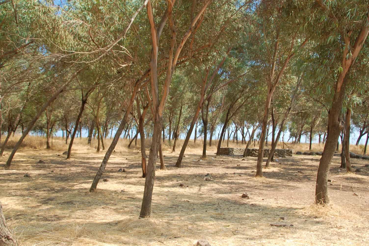
Starting Point :Givat Yoav grove
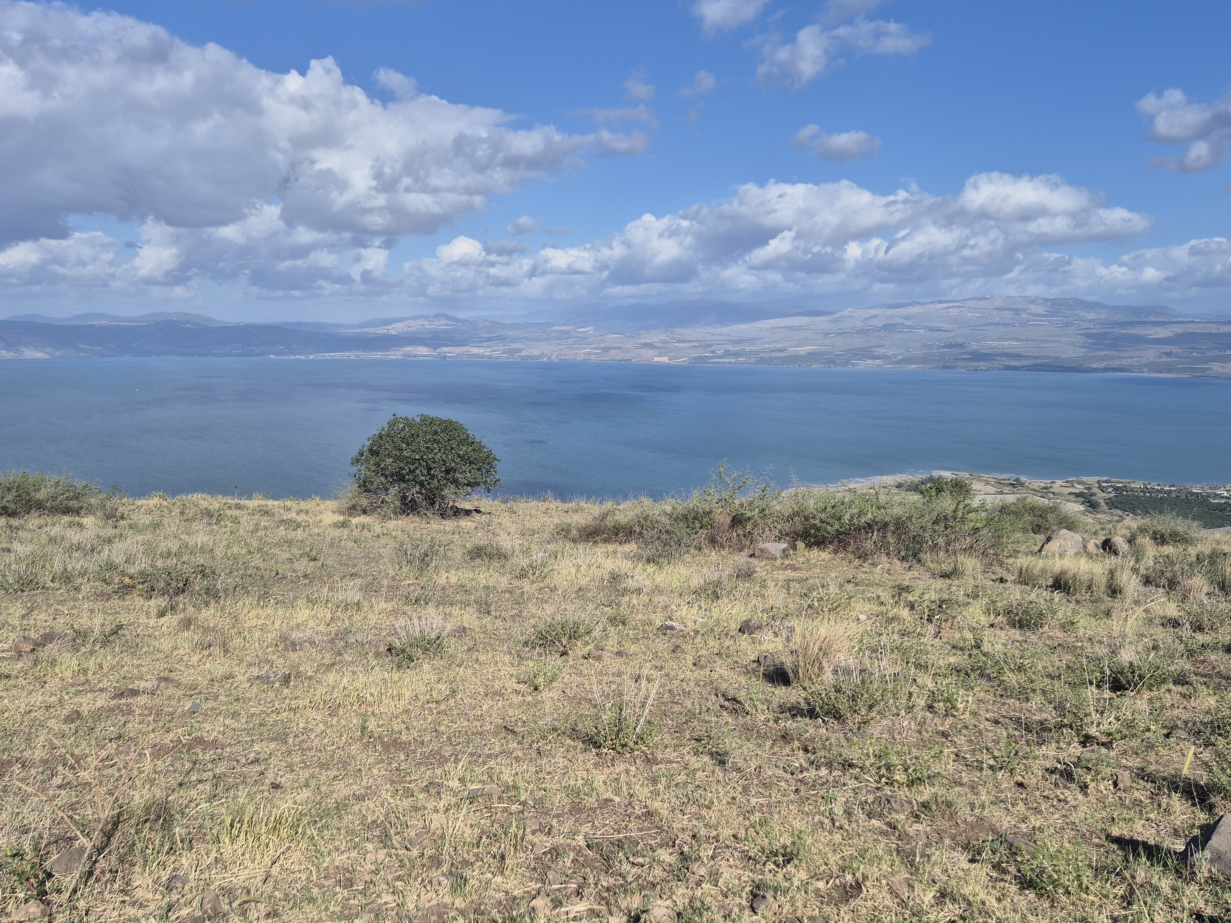
Run about half a kilometer to the viewpoint. This is a convenient place for camping. You can stock up on food and water in Givat Yoav (about half a kilometer away).
From the viewpoint, run another half kilometer until you pass near Old Bnei Yehuda - a settlement established in 1886 by religious Jews from Safed and Tiberias, supported by Baron Rothschild, and abandoned in 1920.
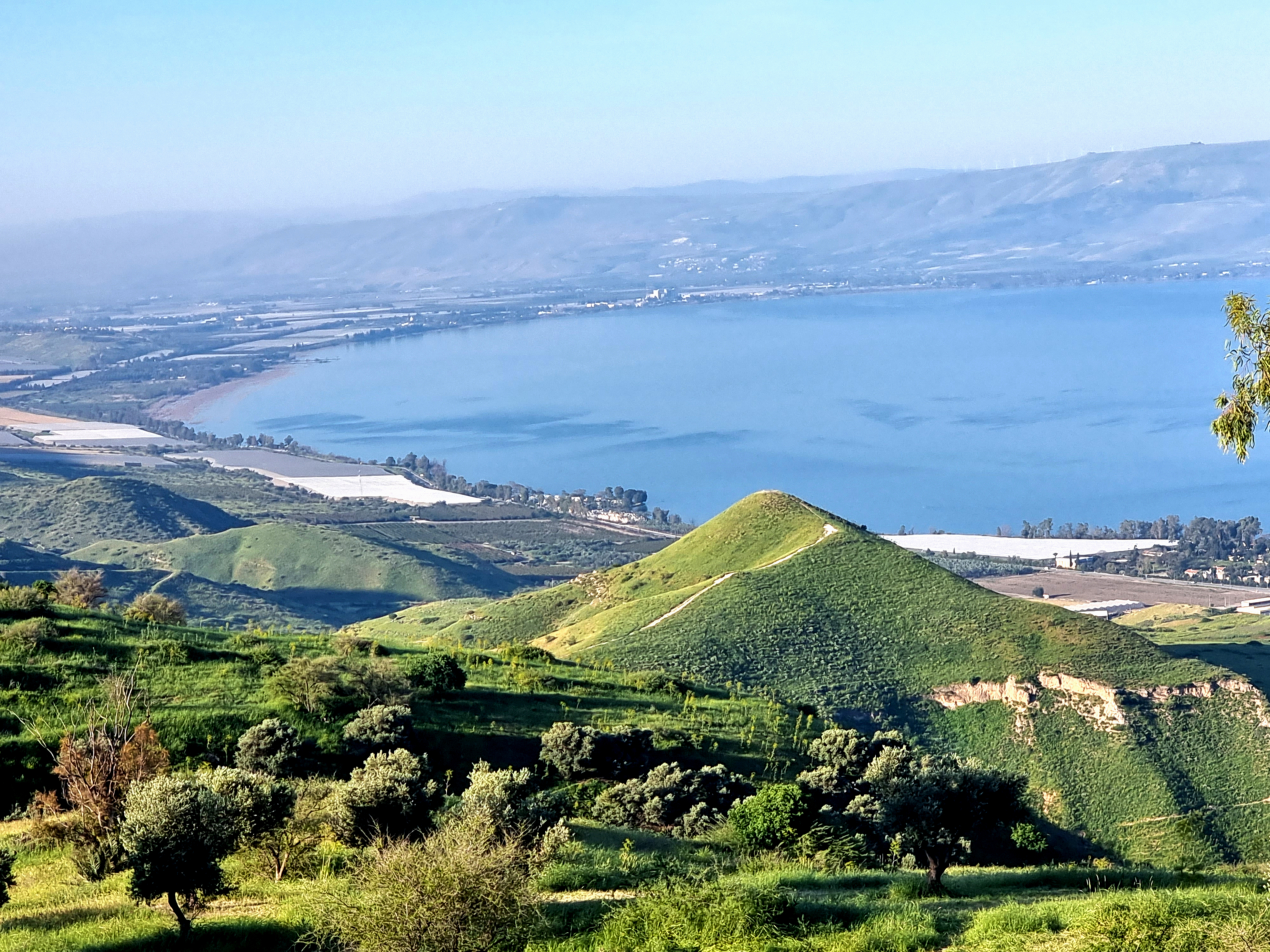
At this point, the trail begins to descend back to the plateau in a relatively moderate manner for most of the way. Run approximately 3 km more or less at the same elevation along the slopes of the Golan Heights, with the Sea of Galilee visible in front of you. This is a wonderful run in good weather.
Continue on the trail until you reach Route 789, the road descending from Givat Yoav to Kursi Junction. Run approximately 3 km more or less at the same elevation until you reach the point where you begin a steep descent of about 2 km with an accumulated elevation loss of 200 meters.
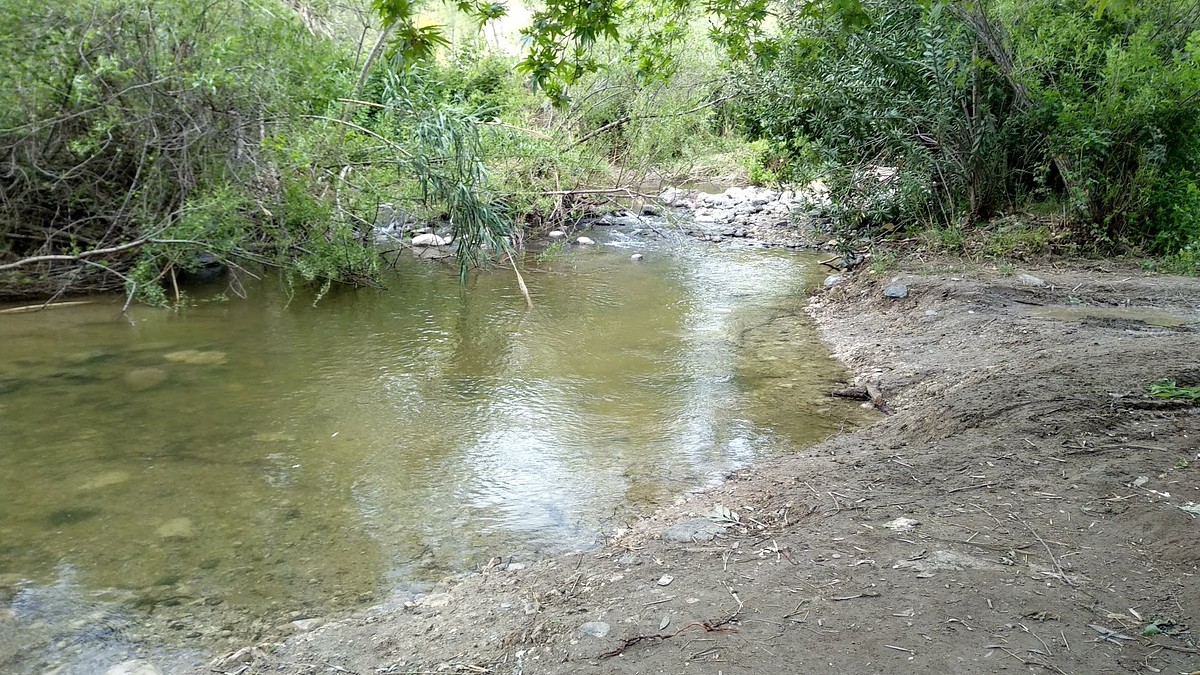
At the bend in the trail, connect to the jeep trail and head north, crossing the Samakh stream. Continue on the trail marked in green, crossing the Samakh stream heading west.
Continue on the dirt road marked in red uphill (total of 4 km) until you reach the Golan Trail and ascend with the black marking back to Umm el-Kanatir.
Starting Point :Givat Yoav grove
Run about half a kilometer to the viewpoint. This is a convenient place for camping. You can stock up on food and water in Givat Yoav (about half a kilometer away).
From the viewpoint, run another half kilometer until you pass near Old Bnei Yehuda - a settlement established in 1886 by religious Jews from Safed and Tiberias, supported by Baron Rothschild, and abandoned in 1920.
At this point, the trail begins to descend back to the plateau in a relatively moderate manner for most of the way. Run approximately 3 km more or less at the same elevation along the slopes of the Golan Heights, with the Sea of Galilee visible in front of you. This is a wonderful run in good weather.
Continue on the trail until you reach Route 789, the road descending from Givat Yoav to Kursi Junction. Run approximately 3 km more or less at the same elevation until you reach the point where you begin a steep descent of about 2 km with an accumulated elevation loss of 200 meters.
At the bend in the trail, connect to the jeep trail and head north, crossing the Samakh stream. Continue on the trail marked in green, crossing the Samakh stream heading west.
Continue on the dirt road marked in red uphill (total of 4 km) until you reach the Golan Trail and ascend with the black marking back to Umm el-Kanatir.
Starting point: Givat Yoav Grove. You can park your car here. Since this is a one-way route, you must leave a vehicle at the finish point. Don’t forget the key.
Keren Engev is the cone-shaped hill on the left side.

Avenir Light is a clean and stylish font favored by designers. It's easy on the eyes and a great go-to font for titles, paragraphs & more.
Avenir Light is a clean and stylish font favored by designers. It's easy on the eyes and a great go-to font for titles, paragraphs & more.
Avenir Light is a clean and stylish font favored by designers. It's easy on the eyes and a great go-to font for titles, paragraphs & more.
Avenir Light is a clean and stylish font favored by designers. It's easy on the eyes and a great go-to font for titles, paragraphs & more.
Mount Tavor – the round-shaped mountain.
You ran along the Samech River (on the left side, north).
From the Samakh streambed and its junction with the El-Al stream, you begin climbing toward Nator and Umm el-Qanṭir. Some of the ascents are quite steep, so you may prefer to walk until you reach the Syrian Water Diversion Line. From there, the way to Umm el-Qanṭir and the cars is short.
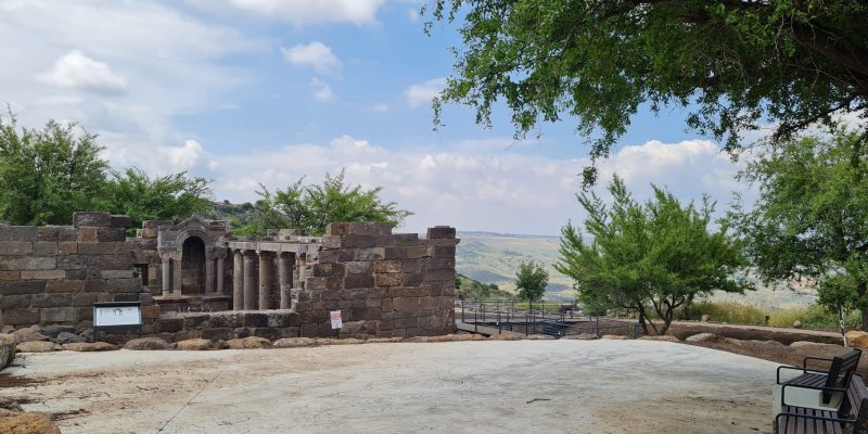
End point: This is the final stop, the parking area near the official archaeological site. You can leave your car here. If you have the time and energy, it's definitely worth visiting the archaeological site of Um El Kantir.
This is the 3D trail.
Legal Notice
Use at the User’s Own Risk
Use of the Israel Trail Running website and app is entirely at the user's own risk.
The site owners, editors, and contributors do not guarantee the accuracy, completeness, or timeliness of the information presented.
Preparation and Verification
Do not begin any trail without first verifying safety conditions, security guidelines, weather, and terrain status with an official and reliable source.
It is the user's responsibility to verify all information and ensure that the area is open, safe, and not a closed military zone or active fire zone.
Trail Files and Descriptions
Trail descriptions and GPX files are theoretical only.
Some trails include life-threatening sections. Entering a trail is solely at the user's own risk.
Trails may change over time; only some have been field-verified.
Safety and Conduct
Carry appropriate gear and follow all safety rules.
Camping is only permitted in designated overnight campsites marked on official maps.
In nature reserves and national parks, movement is allowed only on foot or by vehicle on marked trails and roads.
No Recommendations
Nothing on this site constitutes a recommendation; the content is for informational purposes only.
The site team bears no responsibility for any damage, injury, or loss resulting from the use of the information.
שימוש באחריות המשתמש בלבד
השימוש באתר ובאפליקציית Israel Trail Running הוא באחריות המשתמש בלבד.
בעלי האתר, העורכים והכותבים אינם מתחייבים לדיוק, שלמות או עדכניות של המידע המוצג.
הכנה ואימות
אין לצאת למסלול מבלי לבדוק תחילה מול מקור מוסמך את תנאי הבטיחות, ההנחיות הביטחוניות, מזג האוויר ומצב השטח.
באחריות המשתמש לאמת את כל המידע ולוודא שהאזור פתוח, בטוח, ואינו שטח צבאי סגור או שטח אש פעיל.
קבצי מסלול ותיאורים
תיאורי המסלולים וקבצי GPX הם תיאורטיים בלבד.
חלק מהמסלולים כוללים קטעים מסכני חיים. היציאה למסלול היא באחריות המשתמש בלבד.
מסלולים עשויים להשתנות עם הזמן; רק חלקם נבדקו בשטח.
בטיחות והתנהלות
יש לשאת ציוד מתאים ולפעול לפי כללי הבטיחות.
לינה בשטח מותרת רק בחניוני לילה מוסדרים המסומנים במפות הרשמיות.
בשמורות טבע וגנים לאומיים מותר לנוע רק ברגל או ברכב בשבילים ובדרכים מסומנים.
אין המלצות
שום דבר באתר זה אינו מהווה המלצה; התוכן נועד למטרות מידע בלבד.
צוות האתר אינו נושא באחריות לכל נזק, פציעה או אובדן שייגרמו כתוצאה מהשימוש במידע.