
Hod Hasharon - Afek Park
Lowest point
Cumulative Ascent
Trail Type
Point to Point
Highest point
מנקודה לנקודה
29
Distance
11.58 km, 7.20 miles.
Difficulty Level
1/4


44
11
Cumulative Descent
Navigation File
33
Starting Point
End Point
Hod Hasharon Ecological Park
הפארק האקולוגי הוד השרון
Tel Afek, Antipatris
פארק אפק
Recommended Season
The trail is partially shaded, especially along the first few kilometers, and is suitable for running year-round.
In winter, following heavy rainfall, you may encounter muddy sections, but in most cases, a moderate detour will allow you to continue along the route.
The trail is partially shaded, especially along the first few kilometers, and is suitable for running year-round.
In winter, following heavy rainfall, you may encounter muddy sections, but in most cases, a moderate detour will allow you to continue along the route.
Trail Description
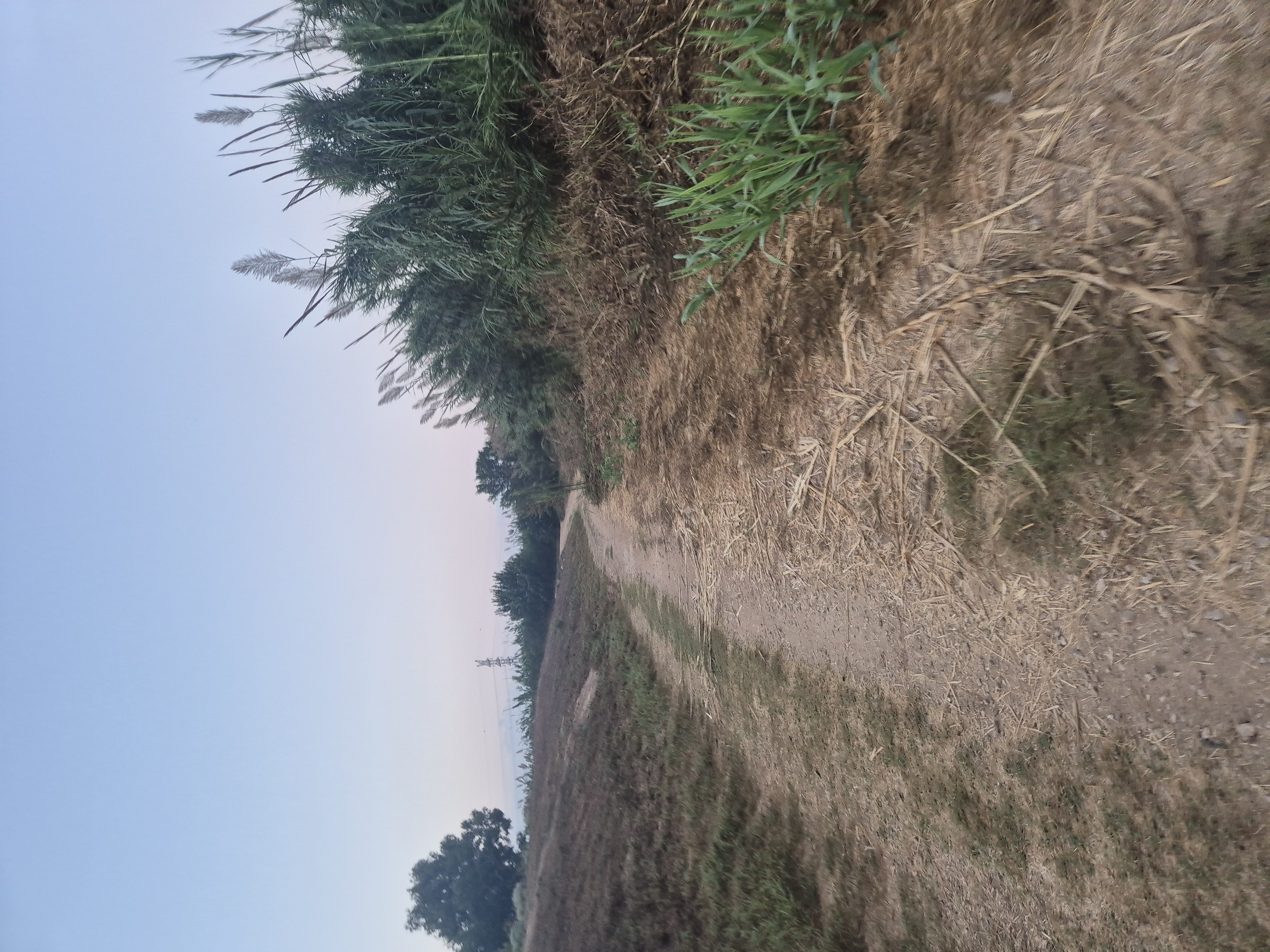
The trail begins at the Hod Hasharon Ecological Park, heading 1.3 kilometers south along the Hadar River until it connects with the marked Israel National Trail.
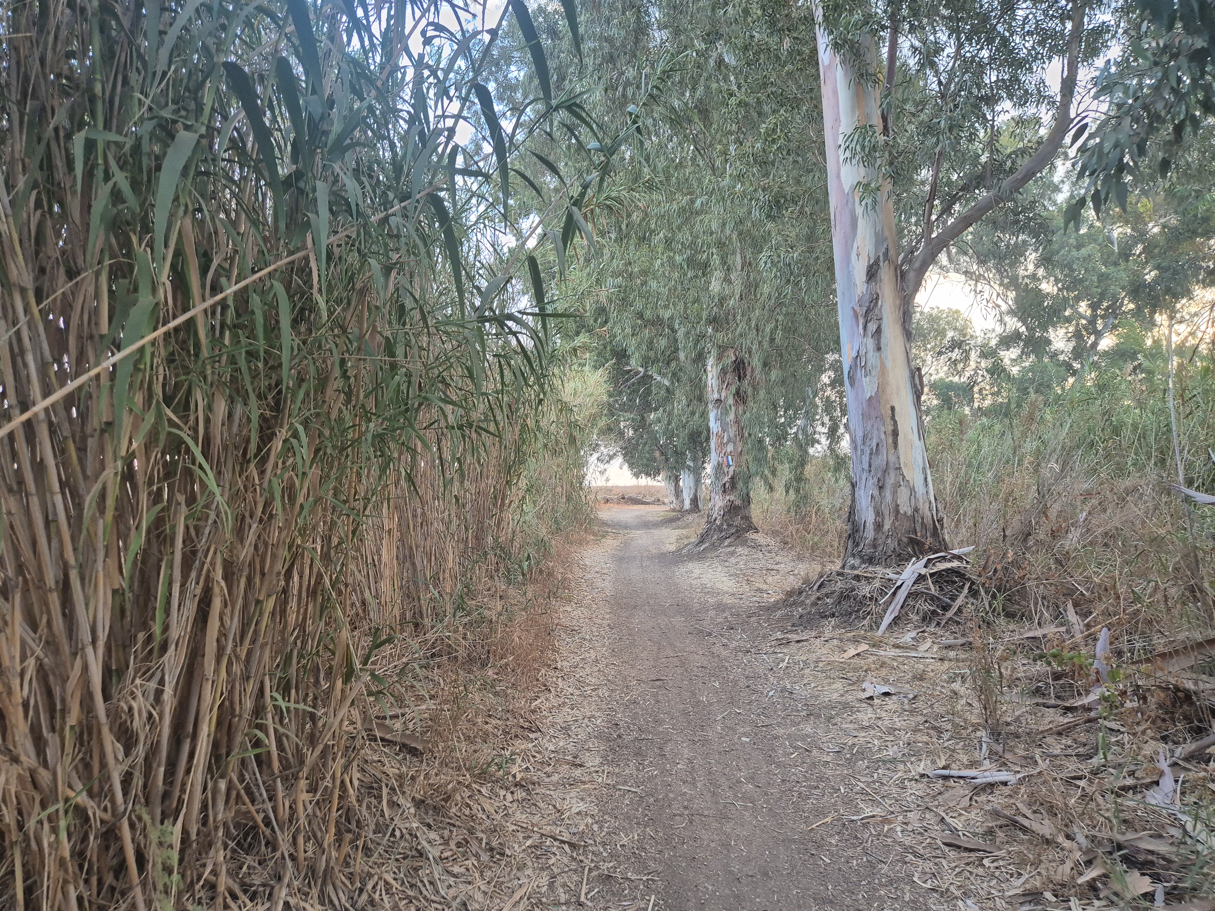
From there, the route continues eastward, following the Yarkon River, all the way to the parking area of the Antipatris Fortress within Park Afek.
Please note:
There are two specific points along the trail where, if you start early in the morning, you may need to temporarily detour and then rejoin the Israel National Trail due to access restrictions or closed gates.
The trail begins at the Hod Hasharon Ecological Park, heading 1.3 kilometers south along the Hadar River until it connects with the marked Israel National Trail.
From there, the route continues eastward, following the Yarkon River, all the way to the parking area of the Antipatris Fortress within Park Afek.
Please note:
There are two specific points along the trail where, if you start early in the morning, you may need to temporarily detour and then rejoin the Israel National Trail due to access restrictions or closed gates.

Avenir Light is a clean and stylish font favored by designers. It's easy on the eyes and a great go-to font for titles, paragraphs & more.
Avenir Light is a clean and stylish font favored by designers. It's easy on the eyes and a great go-to font for titles, paragraphs & more.
Avenir Light is a clean and stylish font favored by designers. It's easy on the eyes and a great go-to font for titles, paragraphs & more.
Avenir Light is a clean and stylish font favored by designers. It's easy on the eyes and a great go-to font for titles, paragraphs & more.

The trail begins at the Hod Hasharon Ecological Park, Start running south
Run for about 200 meters, then follow the path until you reach a small stream.
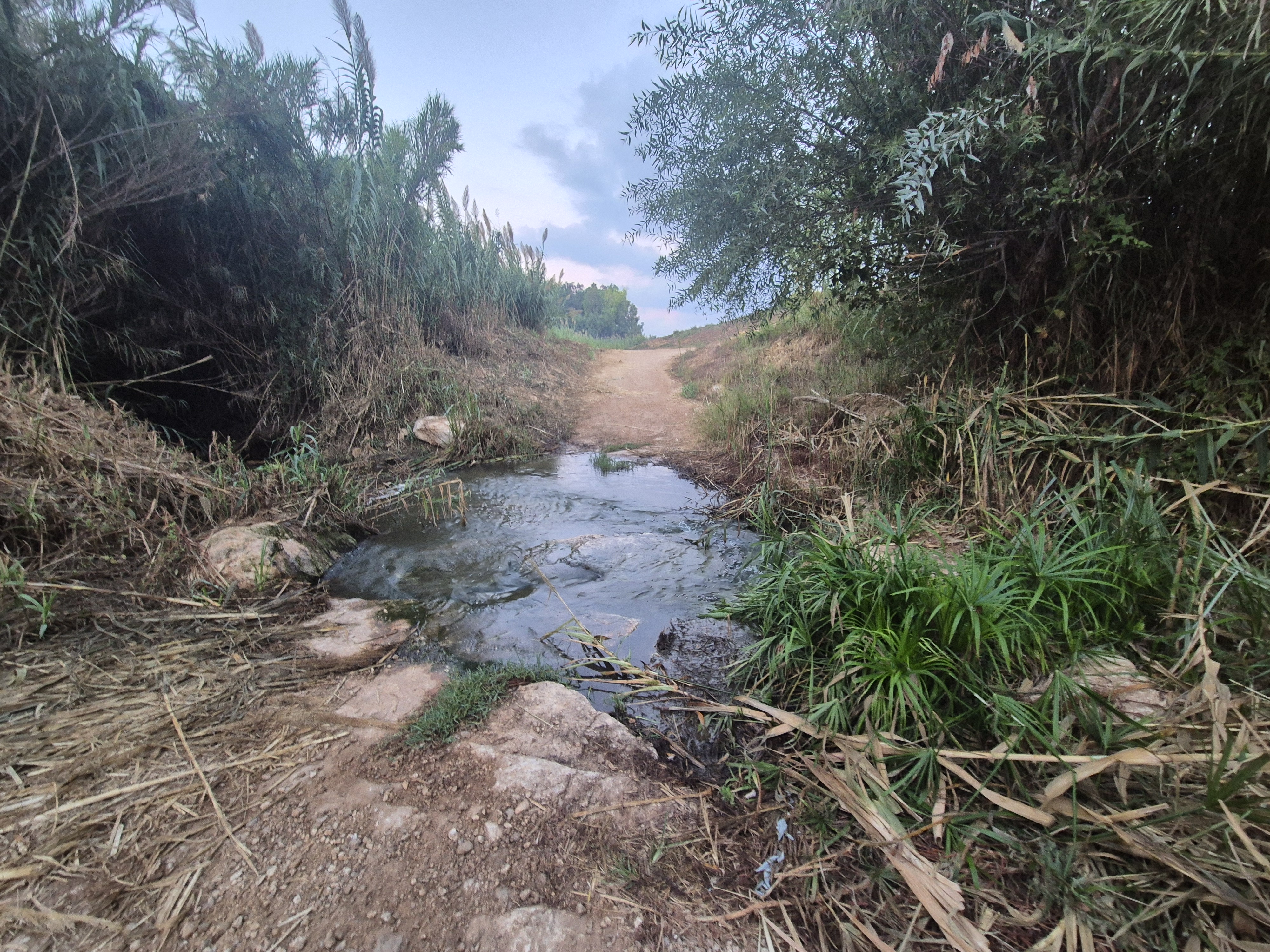
You can either cross the stream or stay on its left (eastern) side and run alongside it until you reach the Israel National Trail. (about 800 meters)
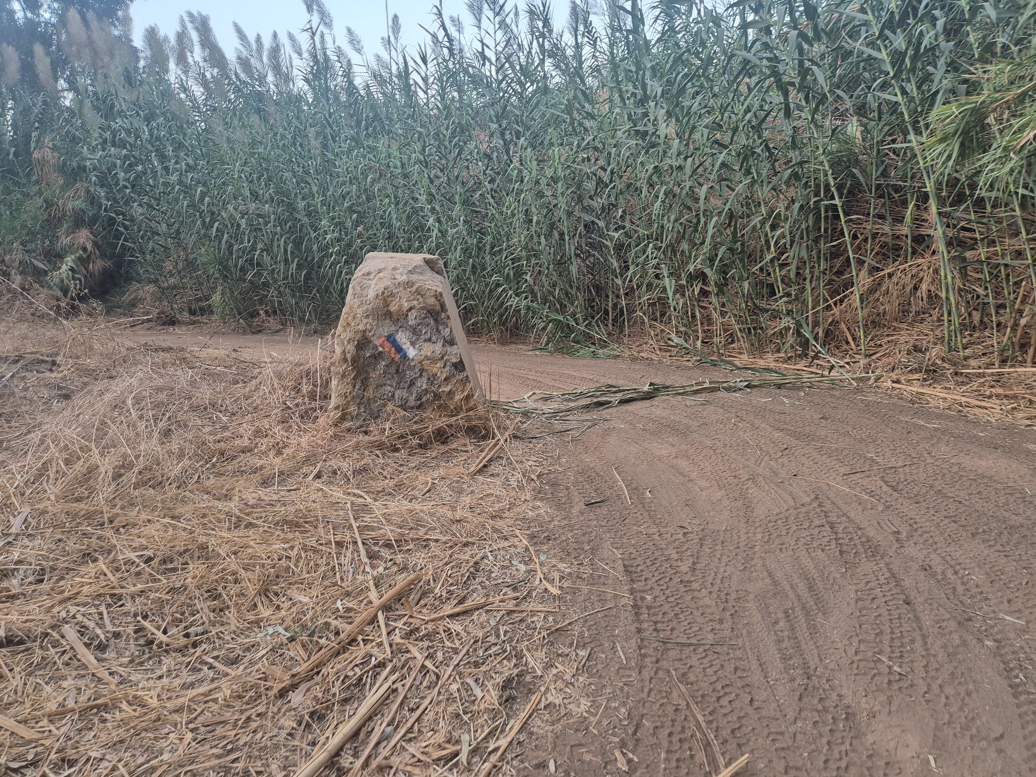
From here, you can follow the Israel National Trail heading east until the trail ends. You'll run alongside the Yarkon River and pass under two major roads via tunnels.
Legal Notice
Use at the User’s Own Risk
Use of the Israel Trail Running website and app is entirely at the user's own risk.
The site owners, editors, and contributors do not guarantee the accuracy, completeness, or timeliness of the information presented.
Preparation and Verification
Do not begin any trail without first verifying safety conditions, security guidelines, weather, and terrain status with an official and reliable source.
It is the user's responsibility to verify all information and ensure that the area is open, safe, and not a closed military zone or active fire zone.
Trail Files and Descriptions
Trail descriptions and GPX files are theoretical only.
Some trails include life-threatening sections. Entering a trail is solely at the user's own risk.
Trails may change over time; only some have been field-verified.
Safety and Conduct
Carry appropriate gear and follow all safety rules.
Camping is only permitted in designated overnight campsites marked on official maps.
In nature reserves and national parks, movement is allowed only on foot or by vehicle on marked trails and roads.
No Recommendations
Nothing on this site constitutes a recommendation; the content is for informational purposes only.
The site team bears no responsibility for any damage, injury, or loss resulting from the use of the information.
שימוש באחריות המשתמש בלבד
השימוש באתר ובאפליקציית Israel Trail Running הוא באחריות המשתמש בלבד.
בעלי האתר, העורכים והכותבים אינם מתחייבים לדיוק, שלמות או עדכניות של המידע המוצג.
הכנה ואימות
אין לצאת למסלול מבלי לבדוק תחילה מול מקור מוסמך את תנאי הבטיחות, ההנחיות הביטחוניות, מזג האוויר ומצב השטח.
באחריות המשתמש לאמת את כל המידע ולוודא שהאזור פתוח, בטוח, ואינו שטח צבאי סגור או שטח אש פעיל.
קבצי מסלול ותיאורים
תיאורי המסלולים וקבצי GPX הם תיאורטיים בלבד.
חלק מהמסלולים כוללים קטעים מסכני חיים. היציאה למסלול היא באחריות המשתמש בלבד.
מסלולים עשויים להשתנות עם הזמן; רק חלקם נבדקו בשטח.
בטיחות והתנהלות
יש לשאת ציוד מתאים ולפעול לפי כללי הבטיחות.
לינה בשטח מותרת רק בחניוני לילה מוסדרים המסומנים במפות הרשמיות.
בשמורות טבע וגנים לאומיים מותר לנוע רק ברגל או ברכב בשבילים ובדרכים מסומנים.
אין המלצות
שום דבר באתר זה אינו מהווה המלצה; התוכן נועד למטרות מידע בלבד.
צוות האתר אינו נושא באחריות לכל נזק, פציעה או אובדן שייגרמו כתוצאה מהשימוש במידע.